 Documentation
A coordinate reference system is a coordinate system that is related to an object
by a geodetic datum.
Mizar currently supports the following coordinates reference systems :
In addition to the classes, a factory is available to help for creating coordinate reference system. Once the coordinate reference system is created, the client can handle it by the use of its interface.
 |
EquatorialCrs | Provides an equatorial coordinate reference system |
 |
GalacticCrs | Provides a galactic coordinate reference system |
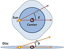
| Mars2000Crs | Provides a coordinate reference system base on the Mars geoide | |
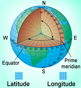 |
WGS84Crs | Provides a coordinate reference system base on the Earth geoide |
| ProjectedCrs | Provides a projected coordinate reference system on a map |
In addition to the classes, a factory is available to help for creating coordinate reference system. Once the coordinate reference system is created, the client can handle it by the use of its interface.
- Implements: