-
getContextConfiguration()
-
Returns the context Configuration
Returns:
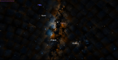
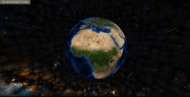
- see options.skyContext or options.planetContext for {Mizar}
-
Type
-
Object
-
getMizarConfiguration()
-
Returns the mizar Configuration
Returns:
- see options.configuration for {Mizar}
-
Type
-
Object
-
getPositionTracker()
-
Returns the position tracker.
Returns:
-
Type
-
PositionTracker
-
getElevationTracker()
-
Returns the elevation tracker.
Returns:
-
Type
-
ElevationTracker
-
setCompassVisible(divName, visible)
-
Sets the compass to visible or not.
Parameters:
| Name |
Type |
Description |
divName |
string
|
Name of the compass div |
visible |
boolean
|
Visible or not |
-
setComponentVisibility(componentId, isVisible)
-
Sets the UI component visibility.
Parameters:
| Name |
Type |
Description |
componentId |
string
|
Id of the component |
isVisible |
boolean
|
Sets to True when the component must be visible |
-
showComponents()
-
Shows components in the current state given by this.components.
-
show()
-
Start Navigation and "Show" sky or planet component.
-
hideComponents(uiArray)
-
Hide components
Parameters:
| Name |
Type |
Description |
uiArray |
|
Array of components,which must not be hide. |
-
hide()
-
Stop navigation and hide sky or planet components.
-
showAdditionalLayers()
-
Shows the additional layers.
-
hideAdditionalLayers()
-
Hides the additional layers.
-
getLonLatFromPixel(x, y)
-
Returns the lon-lat from a pixel.
The pixel is expressed in the canvas frame, i.e. (0,0) corresponds to the lower-left corner of the pixel
Parameters:
| Name |
Type |
Description |
x |
int
|
the x pixel coordinate |
y |
int
|
the y pixel coordinate |
Returns:
an array of two numbers [lon,lat] or null if the pixel is not on the globe
-
Type
-
Array.<float>
-
getPixelFromLonLat(longitude, latitude)
-
Returns the pixel coordinates from longitude/latitude in decimal degree.
Parameters:
| Name |
Type |
Description |
longitude |
float
|
lonitude in decimal degree in the current coordinate reference system |
latitude |
float
|
latitude in decimal degree in the current coordinate reference system |
Returns:
pixels coordinates in the canvas
-
Type
-
Array.<int>
-
getElevation(lon, lat)
-
Returns the elevation at a geo position.
Parameters:
| Name |
Type |
Description |
lon |
float
|
the longitude in degree |
lat |
float
|
the latitude in degree |
Returns:
the elevation in meter at the position [lon,lat]
-
Type
-
float
-
getLayers()
-
Returns the layers of a specific context.
Returns:
an array of layers
-
Type
-
Array.<Layer>
-
getLayerByID(layerId)
-
Returns the layer based on its ID.
Looks through each value in the layer list, returning the first one that matches the ID,
or undefined if no value passes the test.
The function returns as soon as it finds an acceptable element, and doesn't traverse the entire list.
Parameters:
| Name |
Type |
Description |
layerId |
string
|
the layer identifier |
Returns:
the layer
-
Type
-
Layer
|
undefined
-
getLayerByName(layerName)
-
Returns the layer based on its name.
Looks through the list of layers and returns the first value that matches the name of the layer.
If no match is found, undefined will be returned.
Parameters:
| Name |
Type |
Description |
layerName |
string
|
Name of the layer |
Returns:
the layer
-
Type
-
Layer
|
undefined
-
setBackgroundLayer(survey)
-
Sets the background survey.
Parameters:
| Name |
Type |
Description |
survey |
string
|
The name of the layer |
Fires:
Returns:
the layer which has been added to the background
-
Type
-
Layer
|
undefined
-
setBackgroundLayerByID(surveyID)
-
Sets the background survey by layer ID.
Parameters:
| Name |
Type |
Description |
surveyID |
string
|
The name of the layer |
Returns:
the layer which has been added to the background
-
Type
-
Layer
|
undefined
-
getAdditionalLayers()
-
Returns the additional layers.
Returns:
the additional layers by opposition to the background layers
-
Type
-
Array.<Layer>
-
addLayer(mizarDescription)
-
Registers a new layer to globe to be visualized on the globe.
When layerPlanet is defined, the layer is added to the layerPlanet otherwise the
layer is added to the globe.
According to the attributes of the layer, the layer is either added as background or
as additional layer.
Parameters:
| Name |
Type |
Description |
mizarDescription |
Object
|
See the base properties AbstractLayer.configuration and specific properties for specific layers |
Fires:
- Context#backgroundLayer:add
- Context#additionalLayer:add
Returns:
the created layer
-
Type
-
Layer
-
removeLayer(layerID)
-
Removes a layer based on its identifier
Parameters:
| Name |
Type |
Description |
layerID |
string
|
the layer identifier |
Returns:
the removed layer
-
Type
-
Layer
-
removeAllLayers()
-
Removes all layers.
-
addDraw(layer)
-
Adds a temporary draw as a layer on the globe.
A temporary draw is used to create a subLayer or a simple draw. This added layer is not searchable and does not
subscribe to "visibility:changed" by configuration
Parameters:
| Name |
Type |
Description |
layer |
Layer
|
|
-
removeDraw(layer)
-
Removes the temporary draw on the globe.
Parameters:
| Name |
Type |
Description |
layer |
Layer
|
|
-
getRenderContext()
-
Returns the rendering context.
Returns:
The rendering context
-
Type
-
RenderContext
-
getMode()
-
Returns the mode of the globe
Returns:
the mode of the globe
-
Type
-
CONTEXT
-
setCoordinateSystem(cs)
-
Sets the coordinate reference system.
Parameters:
| Name |
Type |
Description |
cs |
|
the coordinate reference system |
Fires:
Throws:
"incompatible coordinate reference system with globe context (e.g : sky, planet)"
-
getCoordinateSystem()
-
Returns the reference coordinate system.
Returns:
the coordinate reference system
-
Type
-
Crs
-
getNavigation()
-
Returns the navigation.
Returns:
navigation
-
Type
-
Navigation
-
addAnimation(anim)
-
Adds an animation.
Parameters:
| Name |
Type |
Description |
anim |
Animation
|
the animation to add |
-
removeAnimation(anim)
-
Removes an animation.
Parameters:
| Name |
Type |
Description |
anim |
Animation
|
the animation to remove |
-
getTileManager()
-
Returns the tile manager.
Returns:
-
Type
-
TileManager
-
dispose()
-
Cleans up every reference to gl objects and unloads all tiles of the current context.
-
refresh()
-
Refreshes rendering, must be called when canvas size is modified.
-
destroy()
-
Destroys the globe of the current context.
The globe is destroyed by :
- cleaning up every reference to gl objects and unloads all tiles
- Removing the renderer from all the tiles
-
disable()
-
Disables the globe of the current context.
-
enable()
-
Enables the globe of the current context.
-
modifiedNavigation
-
Camera view event.
Called when the view of the camera has changed (pan, rotate, ...)
Listeners of This Event:
-
startNavigation
-
Start navigation.
Called when navigation is started (by the user or through animation)
-
endNavigation
-
End navigation.
Called when navigation is ended (by the user or through animation)
-
startLoad
-
startLoad.
Called when a layer start to be loaded
-
endLoad
-
endLoad.
Called when layer end loading
-
backgroundLayer
-
backgroundLayer.
Called when a layer is loaded as background
-
backgroundSurveyError
-
backgroundSurveyError.
Called when a layer could not be loaded as background
Type:
string
-
baseLayersError
-
baseLayersError.
-
baseLayersReady
-
baseLayersReady.
Type:
Layer
|
boolean
Listeners of This Event:
-
startBackgroundLoad
-
startBackgroundLoad.
Called when background layers (imagery and/or elevation) start to be loaded
-
endBackgroundLoad
-
endBackgroundLoad.
Called when background layers (imagery and/or elevation) end loading
-
features:added
-
features:added.
Called when data coming from a GeoJSON are added
Type:
Object
Properties:
| Name |
Type |
Description |
layer |
Layer
|
|
features |
Object
|
|
-
layer:add
-
layer:add.
Called when a layer is added
- See:
-
-
layer:remove
-
layer:remove.
Called when a layer is removed
- See:
-
-
modifiedCrs
-
modifiedCrs.
Called when a CRS changes
 Documentation